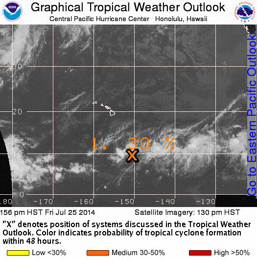
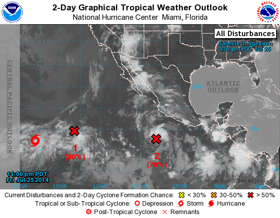
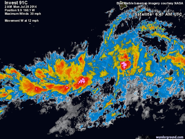
Invest 91C
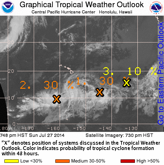
1. Satellite images indicate that shower activity has formed closer to
the circulation center of a low pressure area located about 1500
miles east-southeast of the Big Island of Hawaii. The low is
already producing winds near tropical storm force north of the
center, and any additional increase in organization would lead to
the formation of a tropical depression. The low is forecast to
move westward or west-northwestward at about 10 mph, and upper-level
winds are expected to become less conducive for development during
the weekend.
* Formation chance through 48 hours...high...80 percent.
* Formation chance through 5 days...high...80 percent.
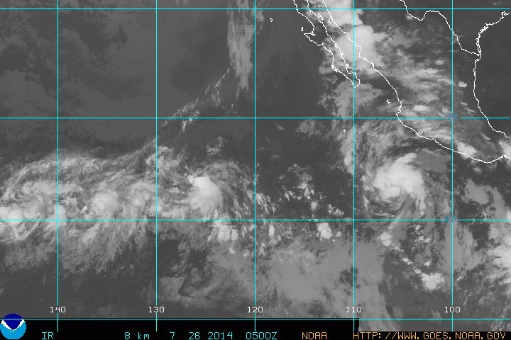
Invest 92E
2. An area of low pressure located about 1100 miles southwest of the
southern tip of the Baja California peninsula is producing
disorganized shower activity. Some development is possible while
the system moves westward or west-northwestward at about 10 mph,
but upper-level winds are forecast to become unfavorable by early
next week.
* Formation chance through 48 hours...low...20 percent.
* Formation chance through 5 days...medium...40 percent.
Invest 91E
3. A large area of disorganized showers and thunderstorms, associated
with a tropical wave, continues well south of the coast of southern
Mexico. Upper-level winds are expected to become somewhat more
favorable for development of this system over the next few days
while it moves west-northwestward at 10 to 15 mph.
* Formation chance through 48 hours...low...20 percent.
* Formation chance through 5 days...medium...50 percent.
4. Another area of low pressure could form well south of southeastern
Mexico by early next week. Some gradual development of this system
is possible after that time.
* Formation chance through 48 hours...low...near 0 percent.
* Formation chance through 5 days...low...20 percent.
Bron: NOAA
Every cloud has a silver lining
Invest 91C
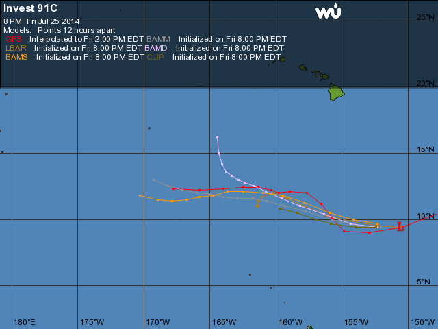
Een ongeorganiseerd lagedrukgebied ligt ten zuidoosten van het Big Island van Hawaii. Het gebied produceert wijdverspreid onweersbuien.
- Location 9.4 150.6W
- Movement W at 10 mph
- Wind 35KPH
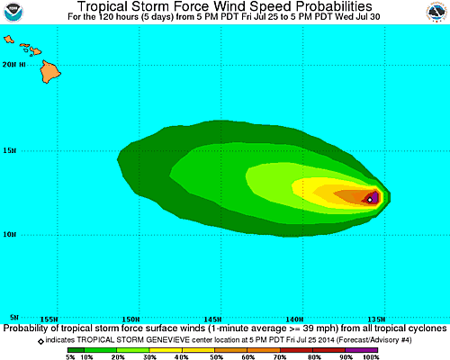
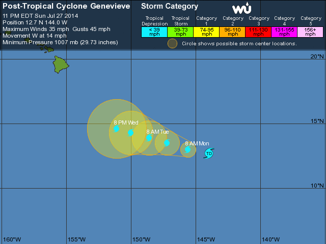
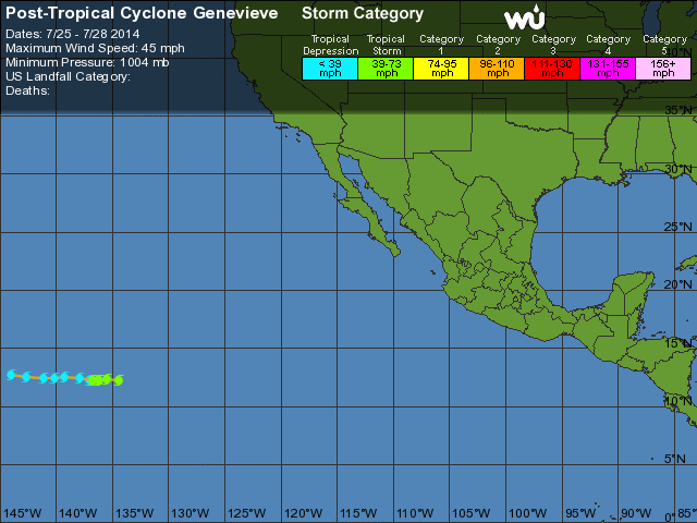
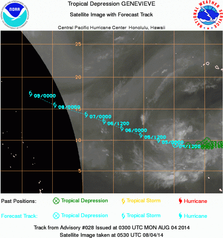
Tropische storm Genevieve
Genevieve trekt langzaam richting het westen.
SUMMARY OF 800 PM PDT...0300 UTC...INFORMATION
----------------------------------------------
LOCATION...12.2N 136.1W
ABOUT 1385 MI...2230 KM ESE OF SOUTH POINT HAWAII
MAXIMUM SUSTAINED WINDS...45 MPH...75 KM/H
PRESENT MOVEMENT...W OR 270 DEGREES AT 5 MPH...7 KM/H
MINIMUM CENTRAL PRESSURE...1004 MB...29.65 INCHES
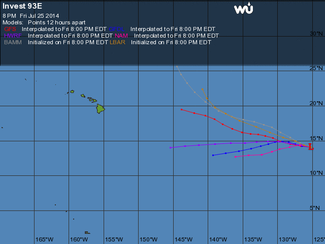
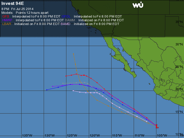
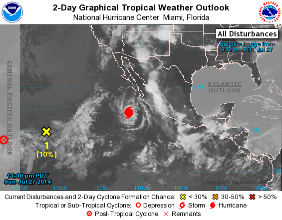
Invest 93E + 94E
1. A low pressure area located about 1200 miles west-southwest of the
southern tip of the Baja California peninsula has changed little in
organization during the past few hours. Although upper-level winds
are currently marginally conducive for development, a tropical
depression could still form during the next day or so while the low
moves westward at about 10 mph.
* Formation chance through 48 hours...high...60 percent.
* Formation chance through 5 days...high...60 percent.
2. Another low pressure area located about 450 miles south-southwest
of Manzanillo, Mexico continues to show signs of organization.
Conditions appear conducive for additional development until Monday,
when the system is expected to reach colder water. A tropical
depression is likely to form during the next day or so while the
low moves west-northwestward or northwestward at 10 to 15 mph.
* Formation chance through 48 hours...high...70 percent.
* Formation chance through 5 days...high...80 percent.
Bron: NOAA, Wunderground
Every cloud has a silver lining
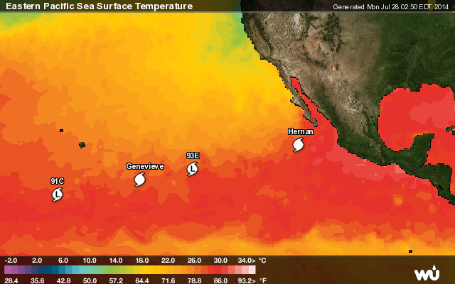
Invest 91C
- Last Updated 28-7-2014, 08:00:00 0
- Location 9.9 160.1W
- Movement W at 15 mph
- Wind 45KPH
-
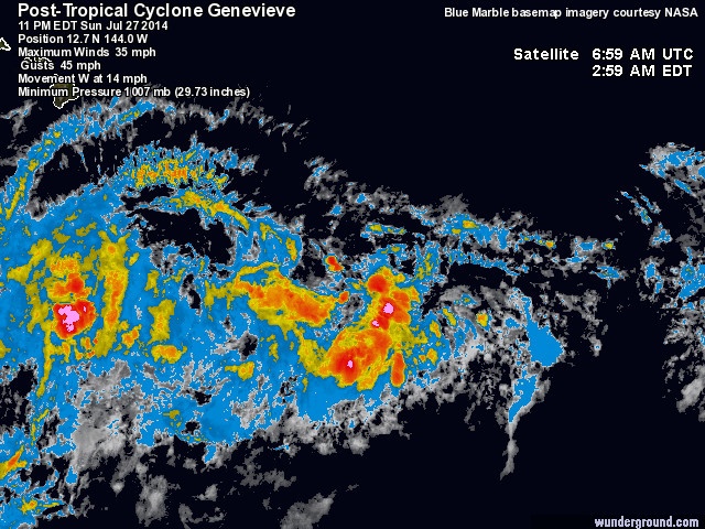
- Last Updated 28-7-2014, 05:00:00 0
- Location 12.7N 144.0W
- Movement W at 14 mph
- Wind 55KPH
- Pressure: 1007 MB
-
-
-
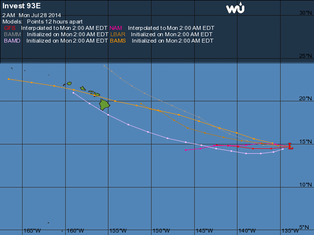
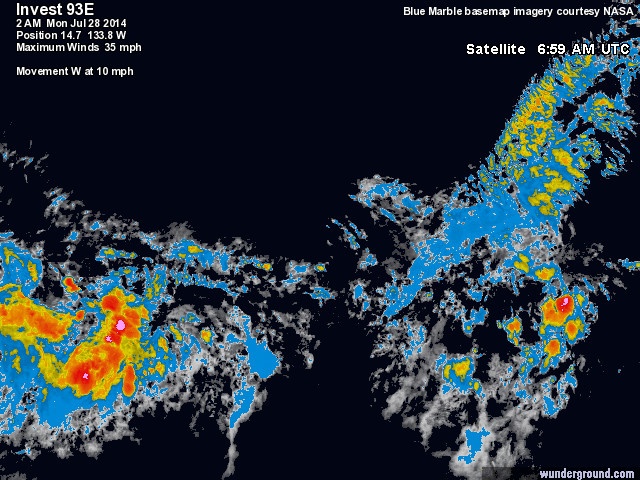
- Last Updated 28-7-2014, 08:00:00 0
- Location 14.7 133.8W
- Movement W at 10 mph
- Wind 55KPH
-
-
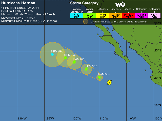
- Last Updated 28-7-2014, 05:00:00 0
- Location 19.3N 113.1W
- Movement NW at 15 mph
- Wind 120KPH
- Pressure: 992 MB
-
-
-
Every cloud has a silver lining
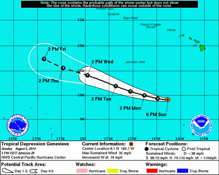
Genevieve nog steeds actief
Tropical depression Genevieve far south of the Hawaiian islands continues moving west
SUMMARY OF 500 PM HST...0300 UTC...INFORMATION
LOCATION: 9.1N 162.7W
ABOUT 900 MI: 1450 KM SSW OF HONOLULU HAWAII
ABOUT 695 MI: 1120 KM SE OF JOHNSTON ISLAND
MAXIMUM SUSTAINED WINDS: 35 MPH: 55 KM/H
PRESENT MOVEMENT: W OR 280 DEGREES AT 16 MPH: 26 KM/H
MINIMUM CENTRAL PRESSURE: 1006 MB or 29.71 INCHES

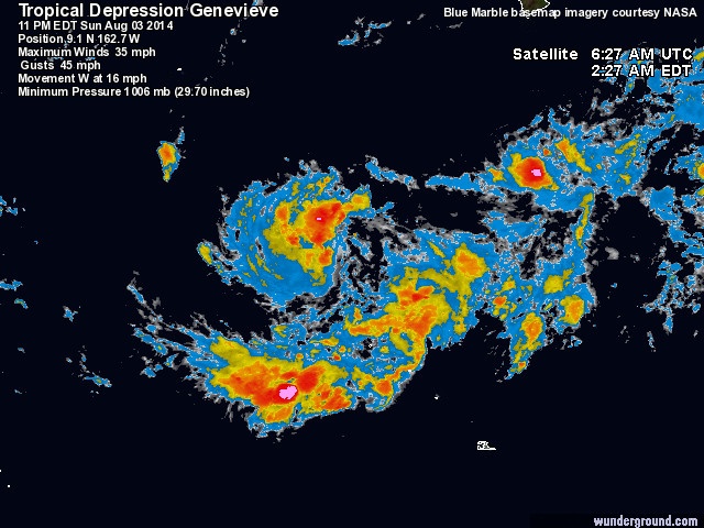
Bron: Wunderground / NOAA
Tropical depression Genevieve far south of the Hawaiian islands continues moving west
SUMMARY OF 500 PM HST...0300 UTC...INFORMATION
LOCATION: 9.1N 162.7W
ABOUT 900 MI: 1450 KM SSW OF HONOLULU HAWAII
ABOUT 695 MI: 1120 KM SE OF JOHNSTON ISLAND
MAXIMUM SUSTAINED WINDS: 35 MPH: 55 KM/H
PRESENT MOVEMENT: W OR 280 DEGREES AT 16 MPH: 26 KM/H
MINIMUM CENTRAL PRESSURE: 1006 MB or 29.71 INCHES
Bron: Wunderground / NOAA
Every cloud has a silver lining
Genevieve still a depression far south of Johnston island
SUMMARY OF 1100 PM HST...0900 UTC...INFORMATION
LOCATION: 10.7N 170.0W
ABOUT 1085 MI: 1745 KM SW OF HONOLULU HAWAII
ABOUT 415 MI: 670 KM S OF JOHNSTON ISLAND
MAXIMUM SUSTAINED WINDS: 35 MPH: 55 KM/H
PRESENT MOVEMENT: WNW OR 285 DEGREES AT 16 MPH: 26 KM/H
MINIMUM CENTRAL PRESSURE: 1006 MB or 29.71 INCHES
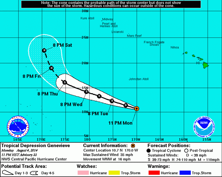
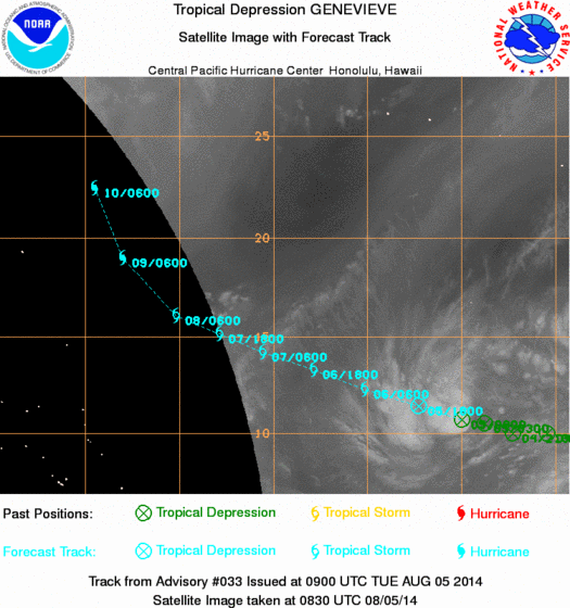
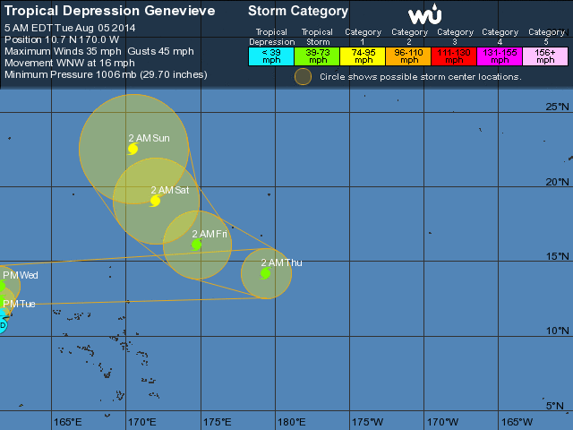
Bron: NOAA / Wunderground
SUMMARY OF 1100 PM HST...0900 UTC...INFORMATION
LOCATION: 10.7N 170.0W
ABOUT 1085 MI: 1745 KM SW OF HONOLULU HAWAII
ABOUT 415 MI: 670 KM S OF JOHNSTON ISLAND
MAXIMUM SUSTAINED WINDS: 35 MPH: 55 KM/H
PRESENT MOVEMENT: WNW OR 285 DEGREES AT 16 MPH: 26 KM/H
MINIMUM CENTRAL PRESSURE: 1006 MB or 29.71 INCHES
Bron: NOAA / Wunderground
Every cloud has a silver lining
Genevieve neemt weer in kracht toe
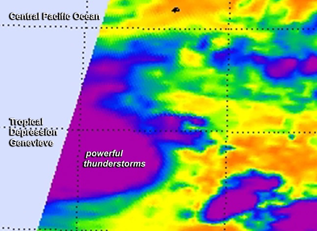
This false-colored infrared image from NASA's Aqua satellite shows powerful thunderstorms (purple) re-developed around Genevieve's center on August 5 at 8:35 a.m. EDT.
Image Credit:
NASA JPL, Ed Olsen | Gewijzigd: 6 augustus 2014, 18:18 uur, door Marga
This false-colored infrared image from NASA's Aqua satellite shows powerful thunderstorms (purple) re-developed around Genevieve's center on August 5 at 8:35 a.m. EDT.
Image Credit:
NASA JPL, Ed Olsen | Gewijzigd: 6 augustus 2014, 18:18 uur, door Marga
Every cloud has a silver lining
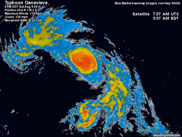
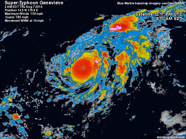
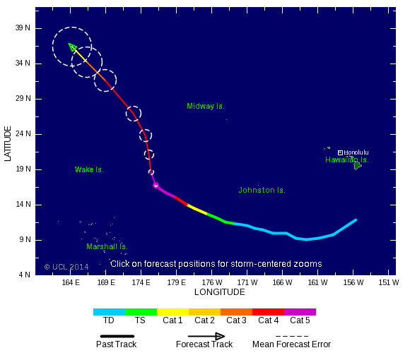
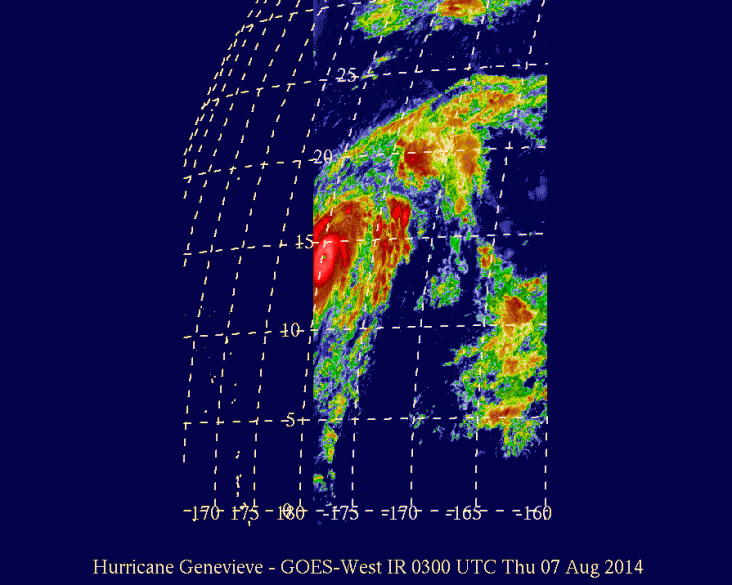
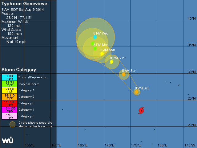
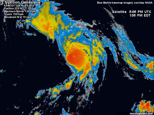
Genevieve becomes a hurricane while moving west northwest toward the international dateline
SUMMARY OF 500 AM HST...1500 UTC...INFORMATION
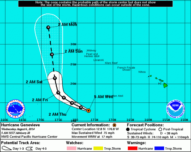
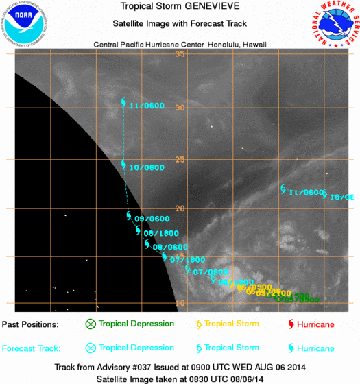
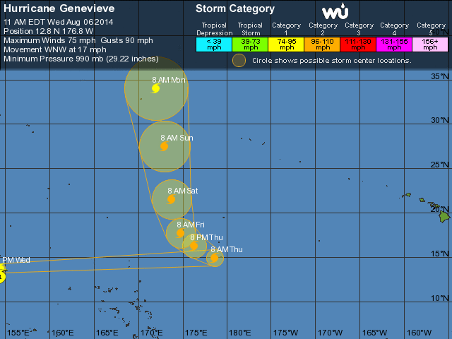
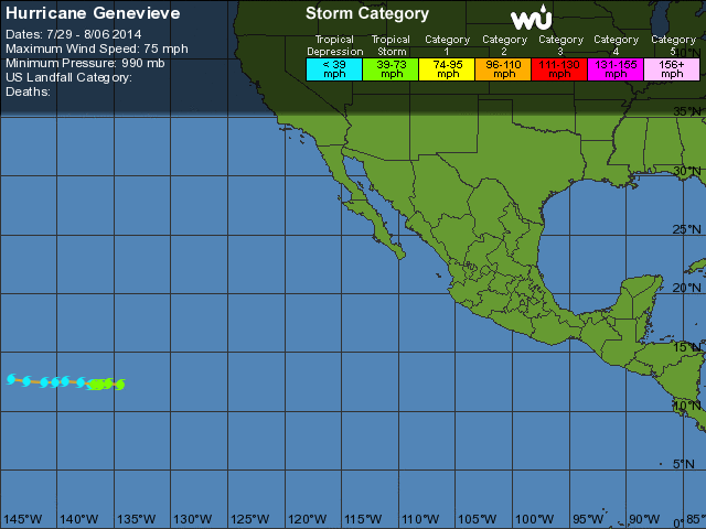
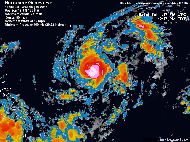
SUMMARY OF 500 AM HST...1500 UTC...INFORMATION
- LOCATION: 12.8N 176.8W
- ABOUT 555 MI: 895 KM WSW OF JOHNSTON ISLAND
- ABOUT 1065 MI: 1710 KM S OF MIDWAY ISLAND
- MAXIMUM SUSTAINED WINDS: 75 MPH: 120 KM/H
- PRESENT MOVEMENT: WNW OR 295 DEGREES AT 17 MPH: 28 KM/H
- MINIMUM CENTRAL PRESSURE: 990 MB or 29.24 INCHES
Every cloud has a silver lining
Genevieve: van orkaan naar supertyfoon
Genevieve heeft met het passeren van de internationale datumgrens een nieuwe benaming gekregen: tyfoon. Hiermee is zij de 13de tyfoon van het seizoen. Genevieve is niet opeens veranderd. Zij is alleen in een gebied terechtgekomen van een andere meteorologische dienst.
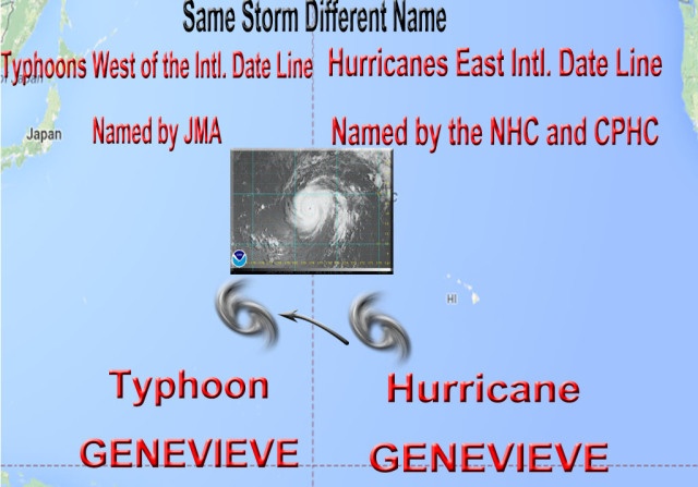
Genevieve heeft met het passeren van de internationale datumgrens een nieuwe benaming gekregen: tyfoon. Hiermee is zij de 13de tyfoon van het seizoen. Genevieve is niet opeens veranderd. Zij is alleen in een gebied terechtgekomen van een andere meteorologische dienst.
Every cloud has a silver lining
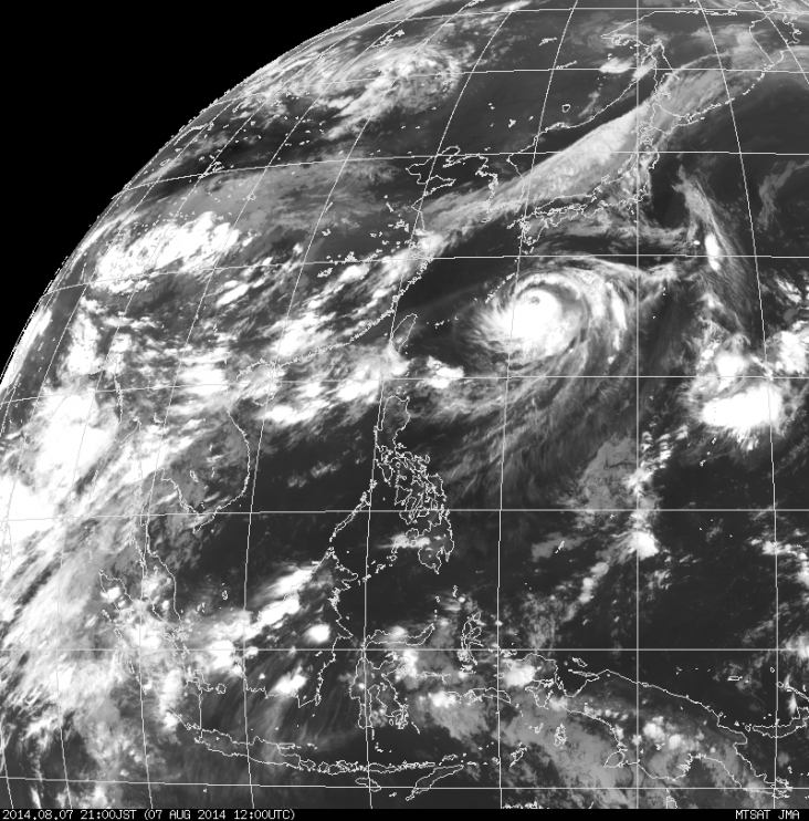
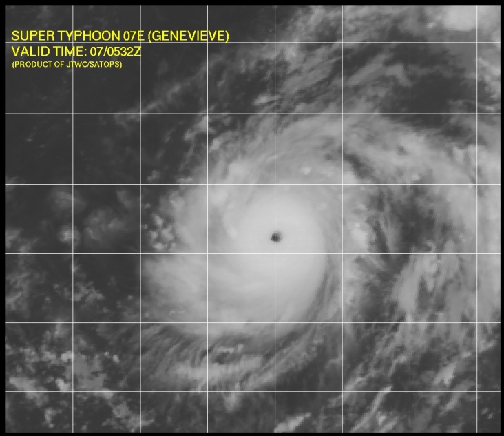
TY 1413 (GENEVIEVE)
Issued at 09:55 UTC, 7 August 2014
<Analyses at 07/09 UTC>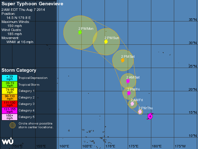
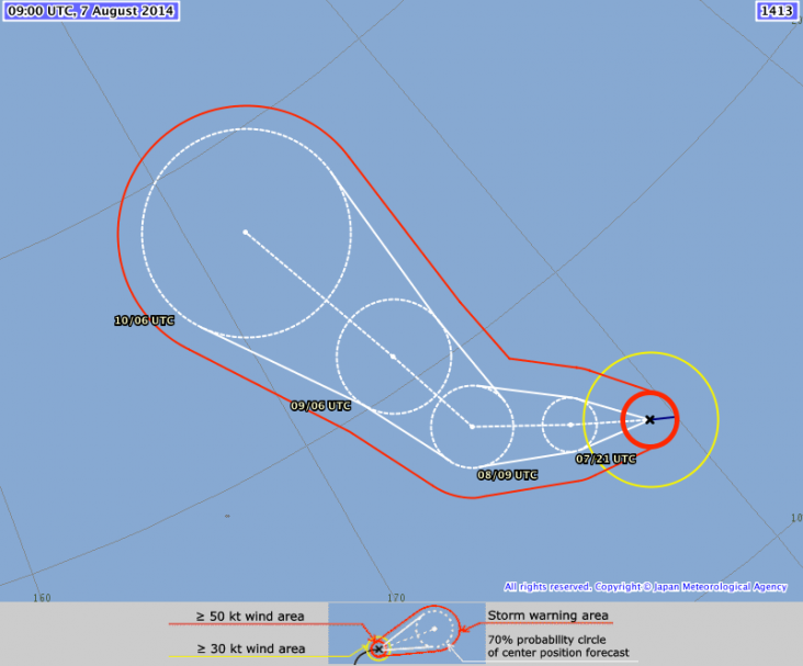
Issued at 09:55 UTC, 7 August 2014
<Analyses at 07/09 UTC>
- Scale -
- Intensity Very Strong
- Center position N14°50'(14.8°) E179°20'(179.3°)
- Direction and speed of movement WNW 30km/h(15kt)
- Central pressure 950hPa
- Maximum wind speed near the center 50m/s(100kt)
- Maximum wind gust speed 70m/s(140kt)
- Area of 50kt winds or more ALL90km(50NM)
- Area of 30kt winds or more ALL220km(120NM)
Every cloud has a silver lining

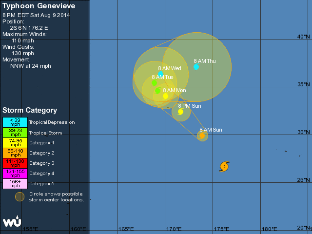
TY 1413 (GENEVIEVE)
Issued at 16:00 UTC, 9 August 2014
<Analyses at 09/15 UTC>
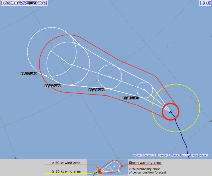
Issued at 16:00 UTC, 9 August 2014
<Analyses at 09/15 UTC>
- Scale -
- Intensity Very Strong
- Center position N23°10'(23.2°)
- E177°20'(177.3°)
- Direction and speed of movement N 25km/h(13kt)
- Central pressure 945hPa
- Maximum wind speed near the center 45m/s(85kt)
- Maximum wind gust speed 60m/s(120kt)
- Area of 50kt winds or more ALL90km(50NM)
- Area of 30kt winds or more E330km(180NM) W190km(100NM)
Every cloud has a silver lining